Map Layers & Overlays
A complete reference for all available map layers, their data sources, and how to toggle them.
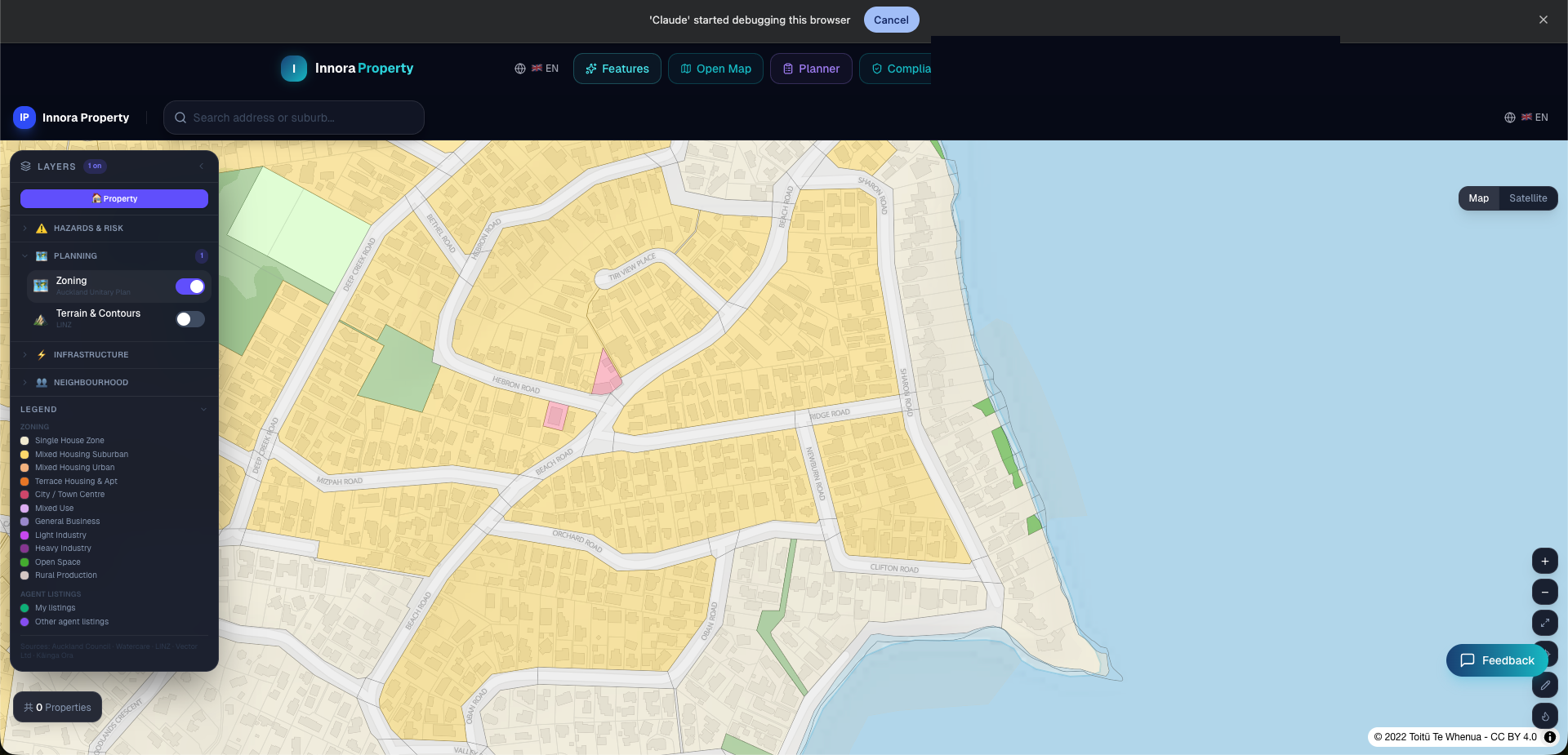
The Layer Control panel (top-right of the map) provides access to 15+ spatial data layers. Layers are grouped by category and can be toggled independently.
Zoning Layers
| Layer | Source | Cities | Notes |
|---|---|---|---|
| AUP Zoning | Auckland Council ArcGIS | Auckland | Operative 2016, full zone type codes |
| CDP Zoning | CCC GeoServer | Christchurch | ZoneAndPrecincts_IHPfix dataset |
| Wellington Zoning | WCC GIS | Wellington | Operative District Plan |
| Hamilton / Tauranga / QLDC / DCC | Respective council GIS | 4 cities | Live zone classification |
Hazard & Flood Layers
- Flood — Auckland Council ArcGIS flood extent polygons (Auckland); available for other cities where council data is exposed
- Active Faults — GNS Science active fault traces, sourced from the NZ Active Faults Database
Council Overlays
The overlay system queries 46 Auckland Council ArcGIS layers in parallel, including Heritage Areas, Volcanic View Shafts (D20A 4 m), Notable Tree Protection Areas, Special Character Areas, and Significant Ecological Areas (SEA). For Christchurch, heritage and character overlays are also available.
Live Data Rate Limiting
Overlay data is fetched live from council servers. If an overlay query fails (e.g., due to council API downtime), the system will display a degraded result with an X-Data-Source: unavailable header rather than presenting incorrect data.
Infrastructure Layers
- Underground Utilities — Water supply, stormwater, and wastewater pipe networks (Watercare for Auckland; WMS services for other cities)
- Power — High-voltage substation locations and power line routes (Vector Ltd / OSM)
- Terrain — Elevation contours and hillshade derived from LINZ DEM data
Neighbourhood Layers
- State Houses — LINZ Crown Residential Surplus Land (CRoSL) dataset showing government-owned housing sites
- HAIL — Hazardous Activities and Industries List contamination screening within 200 m (Auckland SLUR / ECan LLUR)
- Airport Noise — Aircraft noise contour polygons for Auckland, Christchurch, and Wellington airports
- Crime — Meshblock-level crime density sourced from policedata.nz
Found an error? Open an issue on GitHub